


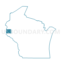
PLEASANT VALLEY - T 1 Voting District, St. Croix County, Wisconsin
About
Outline

Summary
| Unique Area Identifier | 696804 |
| Name | PLEASANT VALLEY - T 1 Voting District |
| County | St. Croix County |
| State | Wisconsin |
| Area (square miles) | 18.06 |
| Land Area (square miles) | 18.06 |
| Water Area (square miles) | 0.00 |
| % of Land Area | 100.00 |
| % of Water Area | 0.00 |
| Latitude of the Internal Point | 44.90583060 |
| Longtitude of the Internal Point | -92.46625690 |
Maps


Graphs
Select a template below for downloading or customizing gragh for PLEASANT VALLEY - T 1 Voting District, St. Croix County, Wisconsin


Neighbors
Neighoring Voting District (by Name) Neighboring Voting District on the Map
- HAMMOND - T 1 Voting District, St. Croix County, WI
- KINNICKINNIC - T 1 Voting District, St. Croix County, WI
- KINNICKINNIC - T 3 Voting District, St. Croix County, WI
- MARTELL - T 2 Voting District, Pierce County, WI
- RIVER FALLS - T 1 Voting District, Pierce County, WI
- RUSH RIVER - T 1 Voting District, St. Croix County, WI
- WARREN - T 1 Voting District, St. Croix County, WI
Top 10 Neighboring County Subdivision (by Population) Neighboring County Subdivision on the Map
- River Falls town, Pierce County, WI (2,271)
- Hammond town, St. Croix County, WI (2,102)
- Kinnickinnic town, St. Croix County, WI (1,722)
- Warren town, St. Croix County, WI (1,591)
- Martell town, Pierce County, WI (1,185)
- Pleasant Valley town, St. Croix County, WI (515)
- Rush River town, St. Croix County, WI (508)
Top 10 Neighboring Unified School District (by Population) Neighboring Unified School District on the Map
- River Falls School District, WI (22,944)
- Baldwin-Woodville Area School District, WI (8,697)
- St. Croix Central School District, WI (7,550)
Top 10 Neighboring State Legislative District Lower Chamber (by Population) Neighboring State Legislative District Lower Chamber on the Map
- Assembly District 29, WI (66,814)
- Assembly District 30, WI (66,575)
- Assembly District 91, WI (56,636)
Top 10 Neighboring State Legislative District Upper Chamber (by Population) Neighboring State Legislative District Upper Chamber on the Map
Top 10 Neighboring 111th Congressional District (by Population) Neighboring 111th Congressional District on the Map
Top 10 Neighboring Census Tract (by Population) Neighboring Census Tract on the Map
- Census Tract 1210, St. Croix County, WI (7,092)
- Census Tract 9602, Pierce County, WI (5,996)
- Census Tract 1209.04, St. Croix County, WI (4,036)